Croatia's best-known waterfalls are Plitvice and Krka, and in July both are queues of people on boardwalks. The quieter alternatives are close by: Berberov buk and Jankovića buk on the Zrmanja river near Obrovac, Sastavci at the far end of Plitvice's Lower Lakes, and Zarečki krov on the Pazinčica river in central Istria. Two of them sit on the southern edge of Lika, one inside it, and one is on the other side of the country, so this guide says plainly where each one is, how you reach it, and whether you can swim.
The short version: go to the Zrmanja for swimming in tufa pools and kayaking, to Sastavci for the classic Plitvice view without the busiest trails, and to Zarečki krov for a deep swimming hole under a rock overhang that is easy to combine with a day in Pazin.
At a glance:
- Berberov buk (Zrmanja, near Obrovac): tufa cascades, swimming pools, end point of rafting and kayak trips. Swimming: yes.
- Jankovića buk (Zrmanja, near Obrovac): the last waterfall before the sea, mill ruins, reached on foot or by boat. Swimming: yes.
- Sastavci (Plitvice Lakes, Lika): a 25-metre fall beside the 78-metre Veliki slap. Swimming: no, banned in the park.
- Zarečki krov (Pazinčica, central Istria): a deep pool under a rock overhang. Swimming: yes, best when the river is high.
- Rastoke (Slunj, on the road to Plitvice): a mill village built over small falls. Best for: a stop on the drive to Plitvice.
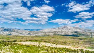
 Lika's high karst fields, the upland region the Zrmanja river drains towards the Adriatic. Image: Perun at German Wikipedia, CC BY-SA 3.0, via Wikimedia Commons.
Where Is Lika?
Lika is the high, thinly populated karst region of central Croatia, wedged between the Velebit mountain range and the coast to the west and the Bosnian border to the east. Most of it lies in Lika-Senj County, and about 90% of Plitvice Lakes National Park is inside that county. It is a landscape of long grassy fields, beech forest and limestone that swallows rivers and releases them again as springs.
The Zrmanja river rises near Gračac on Lika's southern edge and runs about 69 km to the sea, cutting a canyon through the Velebit foothills before it reaches the Novigrad Sea. Its two best-known waterfalls, Berberov buk and Jankovića buk, are in that lower canyon near Obrovac, in Zadar County rather than in Lika itself, and the river corridor is part of Velebit Nature Park. Our Lika region guide covers the towns, caves and national parks of the upland itself.
Berberov Buk: Tufa Cascades on the Zrmanja
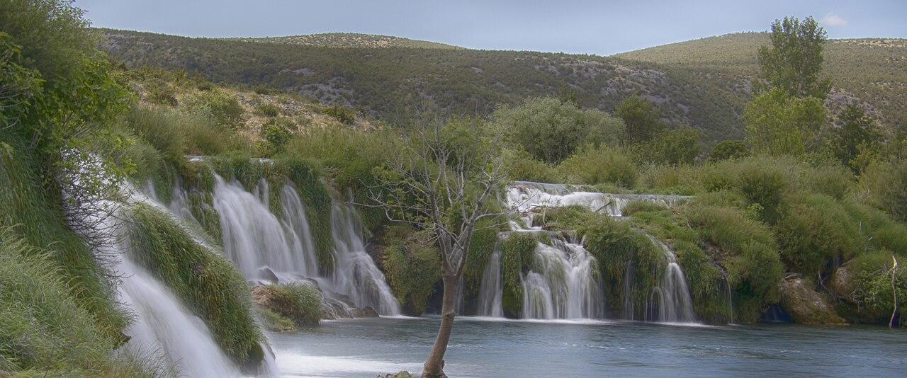
Berberov buk is a broad set of cascades near the hamlet of Muškovci, upstream of Obrovac. The rim the water spills over is tufa, a soft limestone that the karst water deposits as it tumbles, so the falls build their own terraces and rimstone pools instead of cutting into rock. Several smaller falls sit side by side across the river rather than one tall drop, and between them are calm, clear pools.
This is the stretch of the Zrmanja where swimming is the point. The local tourist board's cycling guide describes Muškovci as the place to rest, walk to the "enchanting waterfall" of Berberov buk, visit the village of Ogare and cool off in the river. It is also where most rafting and kayak trips on the upper Zrmanja end: they usually start at Kaštel Žegarski, paddle down through a string of small falls, and finish here, because below Muškovci the river slows down on its way to the sea. Kayak operators run the Kaštel Žegarski route as about 14 km in two sections, with jumps over falls of 1 to 5 metres and a carry around a larger waterfall of about 11 metres.
The water is cold. Operators quote 14 to 20°C in the kayaking season, which is refreshing in August and bracing in May.
Practical info: Berberov buk is beside Muškovci, postal town Obrovac (about 44.197 N, 15.768 E). From Kaštel Žegarski, follow the road towards Bilišane, then turn right onto the gravel road signed for Muškovci. There are several parking areas, cafés and a riverside path of roughly 1 km along the falls; entry was free at the last check. Rafting is best in spring, when the water is high; swimming is best from late June to early September.
Jankovića Buk: the Last Waterfall Before the Sea
Jankovića buk is the last waterfall on the Zrmanja and the last point that boats from the coast can reach. Below it the river turns into a deep, still canyon that runs for about 10 km between Obrovac and the Novigrad Sea, protected as a significant landscape. The fall itself is a wide, low curtain of water across the river, and the banks around it are scattered with the stone ruins of old watermills.
 Jankovića buk, the last waterfall on the Zrmanja, with the ruins of old watermills on the bank. Image: Andrej Vukić, CC BY-SA 4.0, via Wikimedia Commons.
There are two ways to get here. The first is on foot from Obrovac: a riverside trail starts near the old bus station and reaches the waterfall in about an hour, passing the mill ruins and the spot where fresh river water meets the sea. The second is by boat or kayak from the coast: tours leave mostly from Novigrad, some from Starigrad and Obrovac, and the route from the Novigrad Sea up the canyon is about 18 km. Swimming in the turquoise pool below the waterfall is the usual reward.
The canyon is also film history. The Winnetou westerns of the 1960s were shot in this part of Croatia, and the Pariževačka glavica viewpoint above the canyon, about 30 minutes' drive from Novigrad and a 5 to 6 minute walk from its car park, was one of the locations. It also has the best view of the river's bends.
 The pool below Jankovića buk, reached on foot from Obrovac or by boat from the Novigrad Sea. Image: David Brkljača, CC BY-SA 4.0, via Wikimedia Commons.
Practical info: Start the walk in Obrovac (Zadar County), about 40 minutes' drive from Zadar. Allow two hours there and back plus swimming time. For the boat trip, book a canyon tour from Novigrad or Obrovac; spring and autumn are cooler for the walk, and summer is the season for swimming.
While You Are on the Zrmanja: the Krupa River and Kudin Most
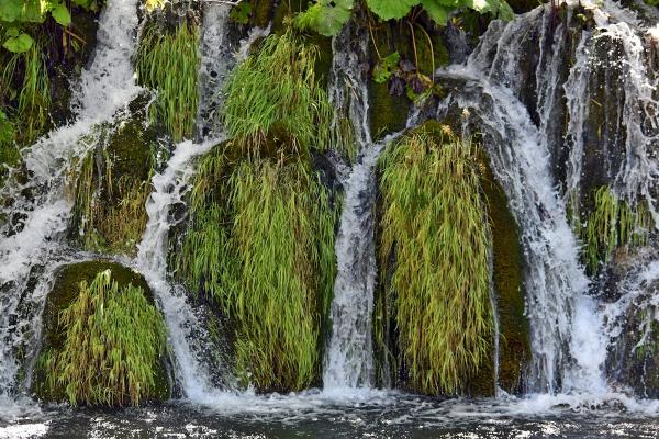
The Zrmanja's most interesting tributary, the Krupa, joins it near Golubić and is worth a half-day on its own. Its best-known sight is Deveterac, a wide tufa barrier named after its nine cascades. Further up, Kudin most is an old stone footbridge over a chain of small falls, reached on a walking trail through the canyon. The area is also home to Krupa Monastery, an Orthodox monastery on the river.
 The Krupa canyon, the Zrmanja's tributary, with tufa barriers and small falls. Image: Anil Öztas, CC BY-SA 4.0, via Wikimedia Commons.
 Kudin most, the old stone footbridge over a chain of small falls on the Krupa. Image: Crowanderers, CC BY-SA 4.0, via Wikimedia Commons.
Practical info: The Golubić–Kaštel Žegarski–Muškovci road links the Krupa, the upper Zrmanja and Berberov buk, so all three fit into one day by car. The Kudin most trail is on unpaved paths: wear proper shoes.
Sastavci: Plitvice's Quieter Waterfall
Sastavci is at the very end of Plitvice's Lower Lakes, where the water of the lake chain pours over a cliff of about 25 metres into the Korana canyon. Next to it is Veliki slap, the "Big Waterfall", which drops 78 metres from the Plitvica stream and is generally given as the highest waterfall in Croatia. Together they form the start of the Korana river. Because Sastavci is beside the most photographed waterfall in the country, it is often missed, but the classic view of both falls from the cliff path above the Lower Lakes is one of the best in the park.
 Sastavci (lower left) and Veliki slap (right), where the waters of the Plitvice Lakes form the Korana river. Image: Falk2, CC BY-SA 4.0, via Wikimedia Commons.
Sastavci is in Lika: Plitvice Lakes National Park lies almost entirely in Lika-Senj County. Unlike the Zrmanja falls, it is not a swimming spot. Swimming is banned everywhere in the national park, as is leaving the marked footpaths, flying drones and walking dogs off the lead.
Practical info: Use Entrance 1 and follow the path along the Lower Lakes; the viewpoint above the canyon near the entrance shows Sastavci and Veliki slap together. Buy a timed ticket in advance on the park's official site (ticketing.np-plitvicka-jezera.hr), and arrive at opening time or in the last hours of the day to avoid the tour-bus peak. See our Plitvice Lakes guide and Veliki slap for the full park.
Zarečki Krov: Istria's Swimming Hole Under a Rock Roof
Zarečki krov ("the roof at Zarečje") is a waterfall on the Pazinčica river a few kilometres from Pazin in central Istria, nowhere near Lika. The river drops several metres over a rock lip into a lake up to about 10 metres deep, under an overhanging ledge that gives the place its name. In summer it is a favourite with local families: people swim, picnic on the rocks, and experienced swimmers jump from the cliffs. Climbers come too, for routes on the overhang that include one of the hardest in Croatia.
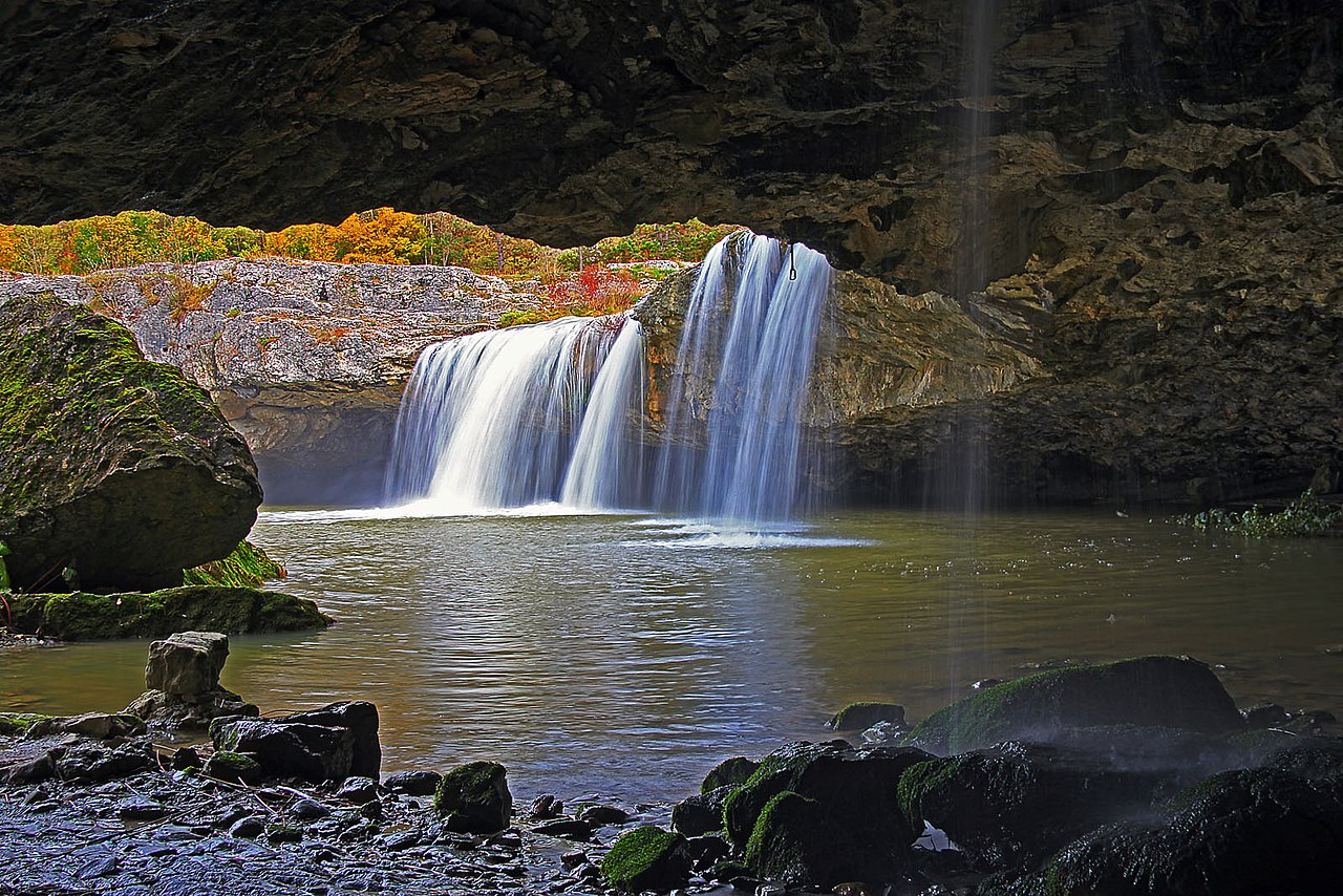 Zarečki krov in full flow, falling into the deep pool under the rock "roof". Image: Vid Pogacnik, CC BY-SA 4.0, via Wikimedia Commons.
Timing matters more here than anywhere else in this guide. The Pazinčica is a small karst river: water levels are highest in spring and early summer, and after a dry summer the waterfall can shrink to a trickle or stop altogether, leaving a still pool. If you want the waterfall rather than just the swim, come in April to June or after autumn rain.
 Zarečki krov in late summer, when the flow drops and the pool becomes a quiet swimming hole. Image: Teknicoloreyes, CC BY-SA 4.0, via Wikimedia Commons.
Practical info: Drive from Pazin towards Zarečje and follow the signs for "Parking Zarečki krov"; a short path by the water leads from the car park to the pool, and a small kiosk nearby sells drinks and coffee. Combine it with Pazin's castle and the Pazin Cave abyss for a half-day.
On the Way to Plitvice: Rastoke in Slunj
If you drive from Zagreb to Plitvice, stop in Slunj. In the old mill quarter of Rastoke, the Slunjčica river splits into branches and falls into the Korana over dozens of small tufa cascades; local sources count around 23. The best known have names: Buk, Hrvoje and Vilina kosa ("fairy's hair"). People built watermills over the falls from at least the 17th century, and some of the wooden mills and houses still stand, so the village is protected as both a natural and a cultural monument. Tufa still grows here at roughly a centimetre a year.
 Wooden mill houses over the Slunjčica in Rastoke. Image: No machine-readable author provided. Neoneo13 assumed (based on copyright claims, Public domain, via Wikimedia Commons.
Practical info: Rastoke is in Slunj (Karlovac County), on the main road between Zagreb and Plitvice and well before the park. Allow one to two hours to walk through the mill quarter and along the Korana.
Planning the Trip
Getting there. You need a car for the Zrmanja and Zarečki krov; public transport does not reach either. Obrovac is about 40 minutes from Zadar, and Plitvice has its own bus connections from Zagreb and Zadar. Zarečki krov is in Istria, so treat it as a separate trip unless you are driving the whole coast.
When to go. Late June to early September for swimming on the Zrmanja and at Zarečki krov; April to June for the strongest waterfalls and the best rafting. Plitvice is spectacular in every season, but the falls are fullest in spring and the paths emptiest from October onwards.
A Zrmanja day from Zadar. Drive to Obrovac (about 40 minutes) and walk to Jankovića buk in the morning (about two hours return). In the afternoon drive up the valley to Muškovci for a swim at Berberov buk, and on the way back stop at Pariževačka glavica for the view over the canyon. With a second day, add the Krupa and Kudin most, or a kayak trip from Kaštel Žegarski.
Respect the tufa. Tufa barriers grow slowly and break easily. Do not climb on the cascades, and use the paths and swimming spots that are already worn rather than new ones.
For more ideas in the area, see the Zrmanja canyon, our Lika region page, and Manojlovac waterfall, the highest in Krka National Park.


,_Krupa-Canyon_--_2022_--_0112.jpg)
.jpg)


